|
|
Post by Jim Boylston on May 4, 2007 22:32:29 GMT -5
View of part of the ruins at Concepcion: 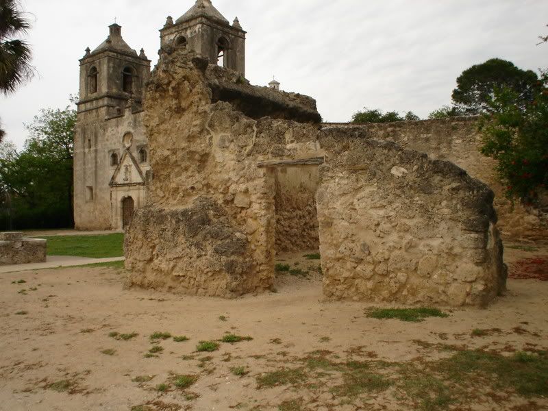 View of the side of the chapel at Concepcion: 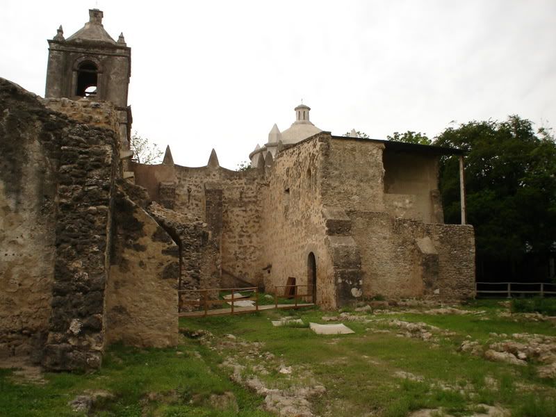 If this were the Alamo, you'd be looking from the southeast toward the chapel. Jim |
|
|
|
Post by TRK on May 5, 2007 10:04:00 GMT -5
Thanks for posting those nice shots, Jim.
Another place, another time, I mentioned what the interior of the church looked like in the Mexican War: how it was full of bats, with guano a foot deep on the floor, and how the dragoons came in and cleaned it up so they could stable their horses there. Four years later, in 1850, John Russell Bartlett, commissioner of the U.S.-Mexico Border Commission, passed through San Antonio. He wrote:
"It was late when we reached Concepcion, which is nearer the town than either of the other missions. The two towers and dome of the church make quite an imposing appearance when seen from a distance; but on approaching it, we found it not only desolated but desecrated; the church portion being used as an inclosure for cattle, the filth from which covered the floor to the depth of a foot or more. Myriads of bats flitted about, which chattered and screamed at our invasion of their territory; and we found nothing of interest within the church to repay us for encountering their disagreeable presence."
BTW, there's an engraving of Concepcion in Bartlett's book that is virtually from the same standpoint of your first photo.
|
|
|
|
Post by sloanrodgers on May 5, 2007 10:11:00 GMT -5
Wow! Some more nice pics Alamo. It's almost like you could jump in and touch those ancient stone walls. I'll bet there's still bats in the belfry.  |
|
|
|
Post by TRK on May 12, 2007 6:30:14 GMT -5
|
|
|
|
Post by Jim Boylston on May 12, 2007 10:21:34 GMT -5
That's a great link, Tom, and one I hadn't seen before. Unfortunately, I didn't stray far enough from the mission itself to see the area where Fannin was posted.
There's a school right across the street now, and I think some ballfields.
Jim
|
|
|
|
Post by Rich Curilla on Jun 13, 2007 13:37:12 GMT -5
I have seen the Battle of Concepcion map before (have a copy of it in my Bowie notebook). It is, I believe, a 20th. Century concoction (as are most of the others in this collection) and thus subject to errors of the time, but one thing in particular about it I really embrace. It plats the battle as happening one river loop upstream from the *historic* site in modern San Antonio. This fits primary accounts of the battle far better than the commemorated site and Concepcion Park. Unfortunately, it has all been obliterated by the 1960's construction of Interstate 10 north of Mission Concepcion.
|
|
|
|
Post by TRK on Nov 23, 2007 10:44:10 GMT -5
|
|


