|
|
Post by bmoses on Sept 16, 2009 20:00:31 GMT -5
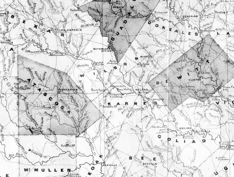 1867 – This military map made in 1867 shows towns, roads, rivers and crossings in areas east and south of San Antonio. Map on file at the Center for Archaeological Research, University of Texas at San Antonio. 1867 – This military map made in 1867 shows towns, roads, rivers and crossings in areas east and south of San Antonio. Map on file at the Center for Archaeological Research, University of Texas at San Antonio.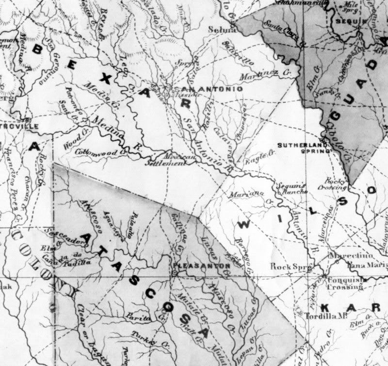 Detail of the area around San Antonio Detail of the area around San Antonio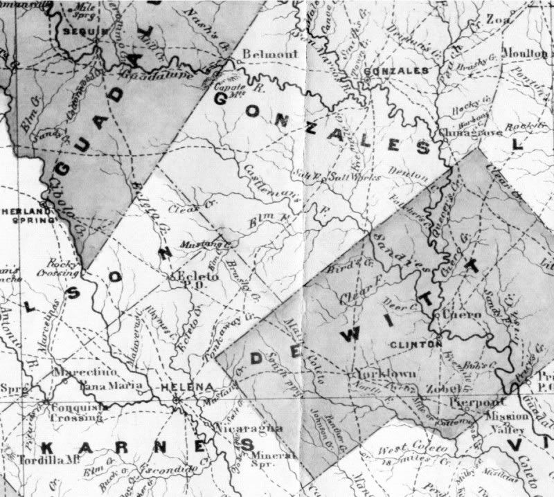 Detail of the area between Seguin and Gonzales. Detail of the area between Seguin and Gonzales.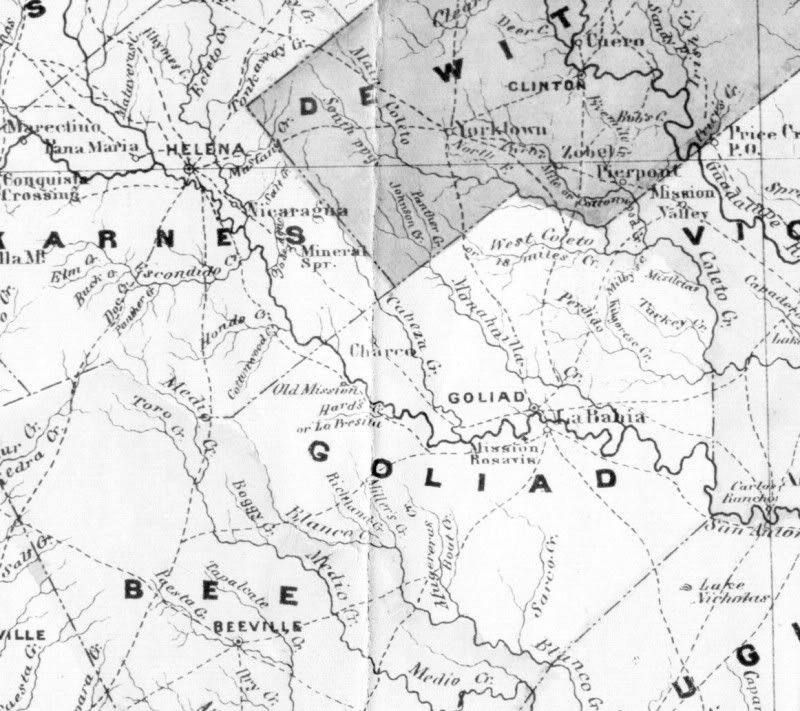 Detail of the area around Goliad. Detail of the area around Goliad. |
|
