|
|
Post by bmoses on Sept 16, 2009 19:20:27 GMT -5
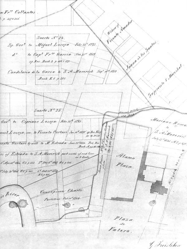 1849 - Plat of the area surrounding Alamo by François Giraud, City Surveyor. This map shows proposed new city streets and blocks as well as original Spanish ownership of these tracts. 1849 - Plat of the area surrounding Alamo by François Giraud, City Surveyor. This map shows proposed new city streets and blocks as well as original Spanish ownership of these tracts.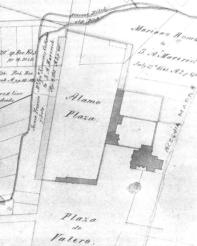 Giraud Map Detail Giraud Map Detail |
|
|
|
Post by TRK on Mar 6, 2011 10:57:45 GMT -5
|
|
|
|
Post by Allen Wiener on Mar 6, 2011 11:17:32 GMT -5
Tom, The Giraud is the same one in Nelson's book (both editions), although it does not mention Giraud; just says it shows old Spanish land grants around the Alamo and Sam Maverick's plans for street and lots faintly superimposed. If you want to find someone to blame for the gradual "deterioration" of the Alamo Plaza area, blame Sam Maverick!  |
|


