|
|
Post by bmoses on Sept 15, 2009 21:27:14 GMT -5
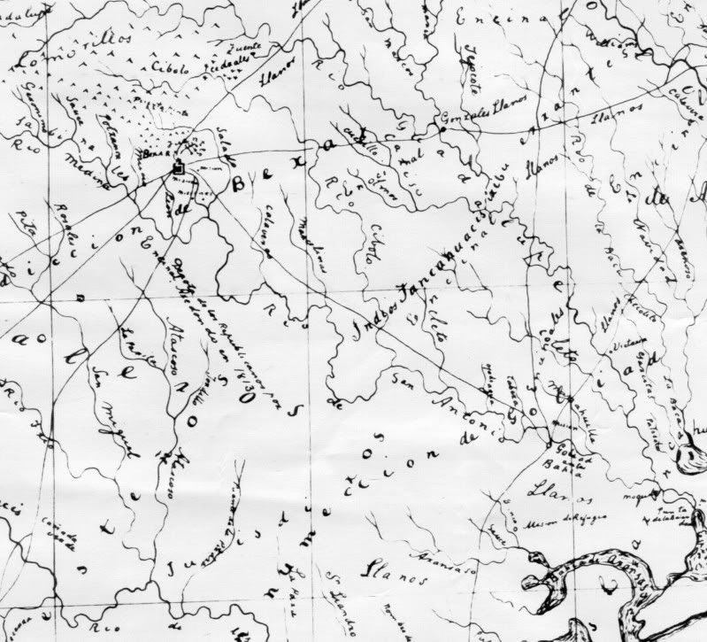 1825(?) – This map, probably sketched by Stephen F. Austin around 1825, shows roads, streams, Indian tribes and major features in the area between Béxar and La Bahía. A copy of this map is on file at the Center for Archaeological Research, University of Texas at San Antonio. 1825(?) – This map, probably sketched by Stephen F. Austin around 1825, shows roads, streams, Indian tribes and major features in the area between Béxar and La Bahía. A copy of this map is on file at the Center for Archaeological Research, University of Texas at San Antonio. |
|
