|
|
Post by bmoses on Sept 24, 2009 7:22:30 GMT -5
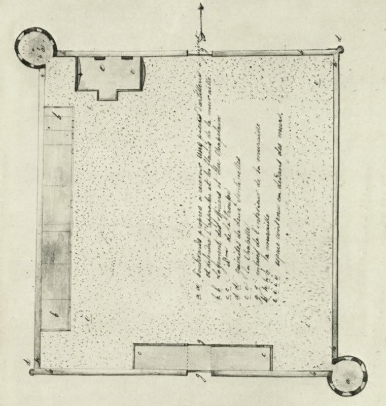 1829 - This map was sketched by Jean Louis Berlandier, a French/Swiss naturalist, during his visit to La Bahía as a member of the Mexican Boundary Commission under leadership of Manuel de Mier y Terán. Berlandier’s caption for this drawing roughly translates “Plan of the presidio which houses troops in case of an Indian attack on Mission la Bahía del Espiritu Santo.” This map is included in “The Indians of Texas in 1830” by Jean Louis Berlandier, Smithsonian Institution, Washington. 1829 - This map was sketched by Jean Louis Berlandier, a French/Swiss naturalist, during his visit to La Bahía as a member of the Mexican Boundary Commission under leadership of Manuel de Mier y Terán. Berlandier’s caption for this drawing roughly translates “Plan of the presidio which houses troops in case of an Indian attack on Mission la Bahía del Espiritu Santo.” This map is included in “The Indians of Texas in 1830” by Jean Louis Berlandier, Smithsonian Institution, Washington. |
|
