|
|
Post by bmoses on Sept 15, 2009 0:01:09 GMT -5
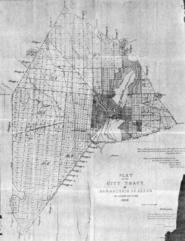 1852 - Jore Gentilz created this plat based on an 1848 boundary survey made by François Giraud of the “Original Town Tract,” The survey was carried out in order to establish proper legal title to lands lying within the city’s boundary. Many areas of the plat depict planned city development, not actual streets and city blocks present in 1852. 1852 - Jore Gentilz created this plat based on an 1848 boundary survey made by François Giraud of the “Original Town Tract,” The survey was carried out in order to establish proper legal title to lands lying within the city’s boundary. Many areas of the plat depict planned city development, not actual streets and city blocks present in 1852.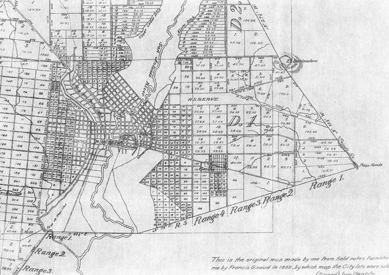 Detail of the central portion of the map. Detail of the central portion of the map.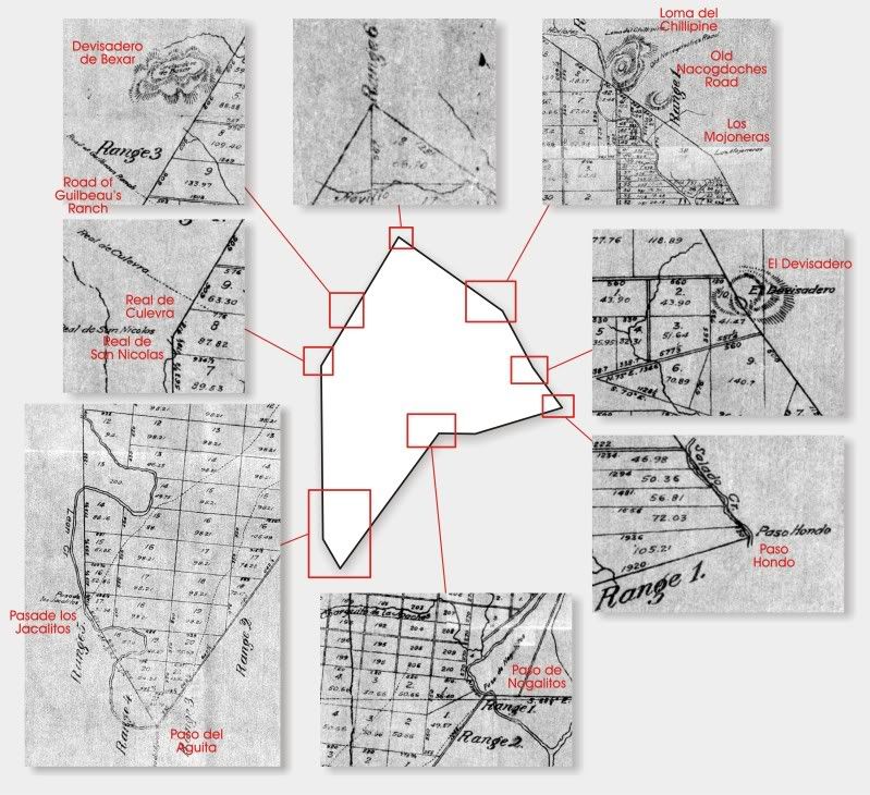 Detail showing boundary points called out in the original town tract. Detail showing boundary points called out in the original town tract. |
|
