|
|
Post by bmoses on Sept 16, 2009 21:14:21 GMT -5
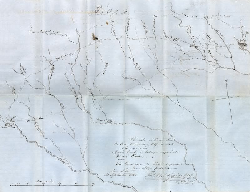 1849 – Sketch map showing route of “General Woll’s road” from the Rio Grande Presidio to San Antonio. The map also depicts and describes the “Coues (?) Route” between these two nodes. The Woll Road is said to be the route Santa Anna’s Army followed into Texas from the Rio Grande to San Antonio. Sketched September 20, 1846, by Major Thomas H. Addicks at San Antonio. Map on file at the Center for Archaeological Research, University of Texas at San Antonio. 1849 – Sketch map showing route of “General Woll’s road” from the Rio Grande Presidio to San Antonio. The map also depicts and describes the “Coues (?) Route” between these two nodes. The Woll Road is said to be the route Santa Anna’s Army followed into Texas from the Rio Grande to San Antonio. Sketched September 20, 1846, by Major Thomas H. Addicks at San Antonio. Map on file at the Center for Archaeological Research, University of Texas at San Antonio. 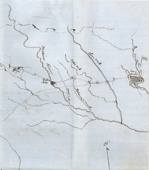 Detail of eastern portion of Addick's sketch including San San Antonio and Quihi. Detail of eastern portion of Addick's sketch including San San Antonio and Quihi.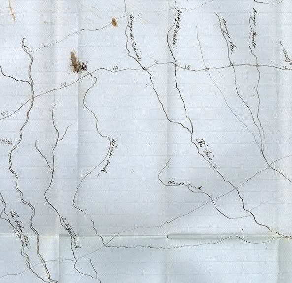 Detail of central portion of Addick's sketch. Detail of central portion of Addick's sketch.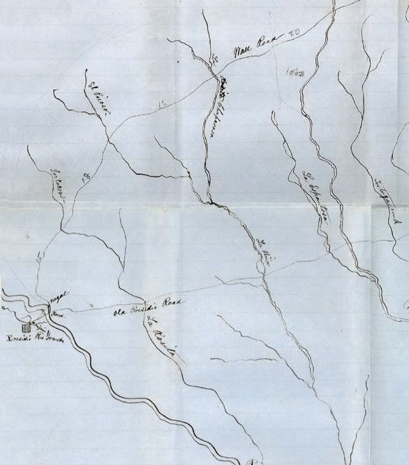
Detail of western portion of Addick's sketch including the Presidio and the Rio Grande.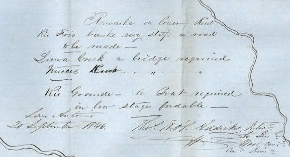 Map legend by Major Thomas H. Addicks. Map legend by Major Thomas H. Addicks. |
|
